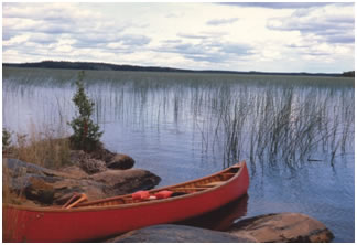
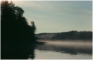
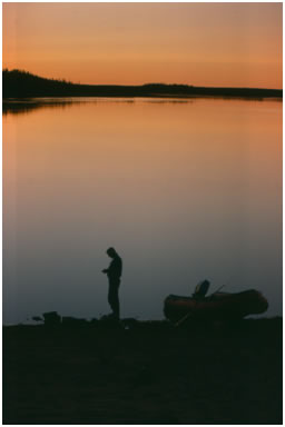
The Hayes River is one of the most natural, scenic and unaltered waterways in Manitoba. The river has provided transportation, livelihoods, and resources to Ininiwak / Cree people for thousands of years. Now part of Treaty 5 territory, the river corridor continues to be home to Ininiw communities including Norway House, Bunibonibee, Manto Sipi, Shamattawa, Fox Lake and York Factory.
In 2006, the Hayes River was designated a Canadian Heritage River in recognition of its outstanding heritage and recreational values. The designation includes the entire 480 km stretch of the Hayes northeast of Lake Winnipeg to Hudson Bay as well as a 43 km section of the Nelson River north from the community of Norway House and the 67 km Echimamish River connecting the Nelson and the Hayes Rivers.
Explore the Hayes River Story Map
Download the Hayes River Management Plan
Download the 2016 Hayes River 10 Year Monitoring Report
Paddling and Trip Details
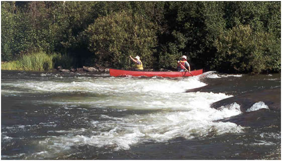
True to historical travel, the Hayes River can be paddled either downstream or upstream, from early June through September. A trip travelling the full downstream route begins at Norway House and ends at York Factory on Hudson Bay, which is approximately 600 km in total. Paddlers can also start their trip at Oxford House, for a 380-kilometre trip. Norway House to Oxford House takes approximately eight to 10 days to paddle, and Oxford House to York Factory takes 14 to 18 days.
However, paddlers must be aware that paddling the full route starting on the Nelson River and ending on the Hayes carries a risk of spreading zebra mussels from the Nelson to the Hayes. Zebra mussels are small, clam-like organisms that are a huge threat to Manitoba's waterways. This aquatic invasive species (AIS) can cause many problems, including threatening fish and wildlife, clogging drinking water infrastructure and watercraft engines, and fouling beaches and shorelines. In August 2019, zebra mussel veligers (microscopic larvae) were detected for the first time in Playgreen Lake and in the Nelson River. As a result, there is a concern that paddlers may inadvertently cause the spread of zebra mussels into the Hayes River when moving canoes or kayaks and water-related equipment (e.g., paddles, ropes, etc.) from the Nelson River to the Hayes via the Echimamish River over Painted Stone Portage.
In order to reduce the risk of spreading zebra mussels and other AIS such as Spiny Waterflea, paddlers must follow the Manitoba government’s AIS Regulation under The Water Protection Act. In addition, the Nelson River and all tributaries of the Nelson River (e.g., Echimamish River) until the first impassible barrier are part of an AIS Control Zone. This means that when a watercraft, including a canoe, exits the Nelson River Control Zone, the boater must do the following before leaving the shore of the water body:
- remove AIS and aquatic plants (e.g., “weeds” and algae) from watercraft and water-related equipment
- drain all water from the watercraft and water-related equipment
- open drain plugs/valves and leave them open while transporting watercraft over land
- dispose of all bait (e.g., live or dead)
In addition to the above and before launching into another water body, the watercraft and water-related equipment must also be decontaminated and then dried completely. To self-decontaminate your watercraft and water-related equipment, you must follow Approved Decontamination Methods. These methods require the use of extremely hot, low pressure water to kill zebra mussels and any other AIS. More details on how to decontaminate can be found here. As well, the AIS Open-water Season checklist is a step-by-step resource that can help you comply with the Manitoba government’s AIS Regulation.
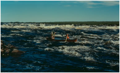
There are over 90 undesignated campsites along the route and approximately 45 sets of rapids and falls, many of which are runnable by experienced whitewater canoeists. There are also 27 portages, some of which are pullovers or can be lined. The portages around the larger sets of rapids have fair to good trails. The Robinson Portage is the longest, at 1 km. Canoeists should be very experienced and have whitewater paddling skills, as well as lining, safety and rescue skills. Paddlers should also be aware of the possibility of encountering polar bears on the northern reaches of the Hayes and in the York Factory area. Note that camping is not permitted at York Factory National Historic Site.
Access - How to Get There and Back
By road or rail: It is possible to reach the Hayes River route by vehicle by driving on P.R. 373 to Norway House from either Thompson (about a five hour drive) or Winnipeg (about a 10 hour drive). Alternatively, it is possible to stop about 40 km short of Norway House at the ferry crossing on the Nelson River at Sea River Falls, and begin the trip there. Depending on schedules, it may be possible to leave your vehicle in Wabowden and take the bus from there to Sea River Falls. The ferry across the Nelson River runs daily and is operated by Manitoba Infrastructure (MI). MI ferry schedules are available online at https://www.gov.mb.ca/mit/namo/schedule.html.
VIA Rail provides scheduled train service between Winnipeg, Thompson and Gillam. Contact VIA Rail for schedule information at 1-888-842-7245. Another option for transportation between Winnipeg and Thompson is the bus.
By air: To begin the trip, charter flights and/or scheduled flights are available from Thompson or Winnipeg to Norway House or Oxford House.
Access to the downstream end of the route at York Factory is by air charter only. Pickup arrangements should be made in advance of a trip down the river. Gillam is the nearest road accessible community to which it is possible to arrange charter flights from York Factory. After flying to Gillam you can then travel by train to Thompson. Alternatively, it is possible to arrange a float plane pickup at York Factory to fly you all the way to Thompson. Paddling the coast from York Factory up the Nelson River to Gillam is not recommended, as the Nelson is a big and sometimes dangerous river, with unpredictable fluctuations in water levels due to water releases from the several large hydroelectric dams located on the river.
To find information on companies that offer air charter services in Manitoba, visit Travel Manitoba's Airlines page.
Accommodation and Services
Norway House and Oxford House are the only two communities directly on the Hayes River route. Norway House has a full range of services and accommodations while Oxford House has more limited services. Knee Lake Lodge (www.northstarresort.ca) is also located mid-way down the river.
Maps
Paddlers are advised to use topographical and/or navigational maps when making wilderness canoe trips. The topographical maps that cover the Hayes River route include:
- 1:250,000 scale – 63H (Norway House), 63I (Cross Lake), 53L (Oxford House), 53M (Knee Lake), 53N (Gods River), 54C (Hayes River), 54F (York Factory)
- 1:50,000 scale – 63H/13; 631/4,5,6,7,8,9; 53L/12,13,14,15; 53M/1,2,8; 53N/5,11,12,14; 54C/3,6,7,10,15,16; 54F/1
Topographical maps are available for purchase from Canada Map Sales, 1007 Century Street, Winnipeg, MB. Visit canadamapsales.com, phone 1-877-627-7226, or e-mail mapsales@gov.mb.ca.


